Project Description
This project aimed to analyze low cloud coverage over four European cities—Karlsruhe, Paris, Milan, and Munich—during winter and summer seasons from 2010 to 2020. MODIS satellite data and Google Earth Engine were used to compute cloud frequency and create animated visualizations.
Objectives & Methodology
- Use the MOD09GA cloud mask dataset to detect low clouds.
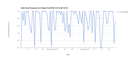
- Analyze cloud frequency over each city during winter (Nov–Jan) and summer (Jun–Aug).
- Compute seasonal pixel-wise cloud occurrence using Terra and Aqua satellites.
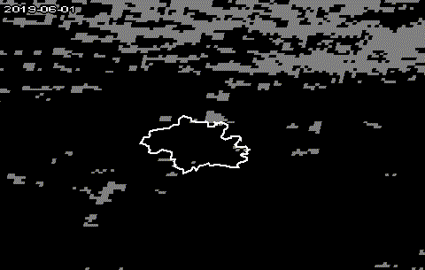
- Create animations and time series to compare spatial and temporal variation.
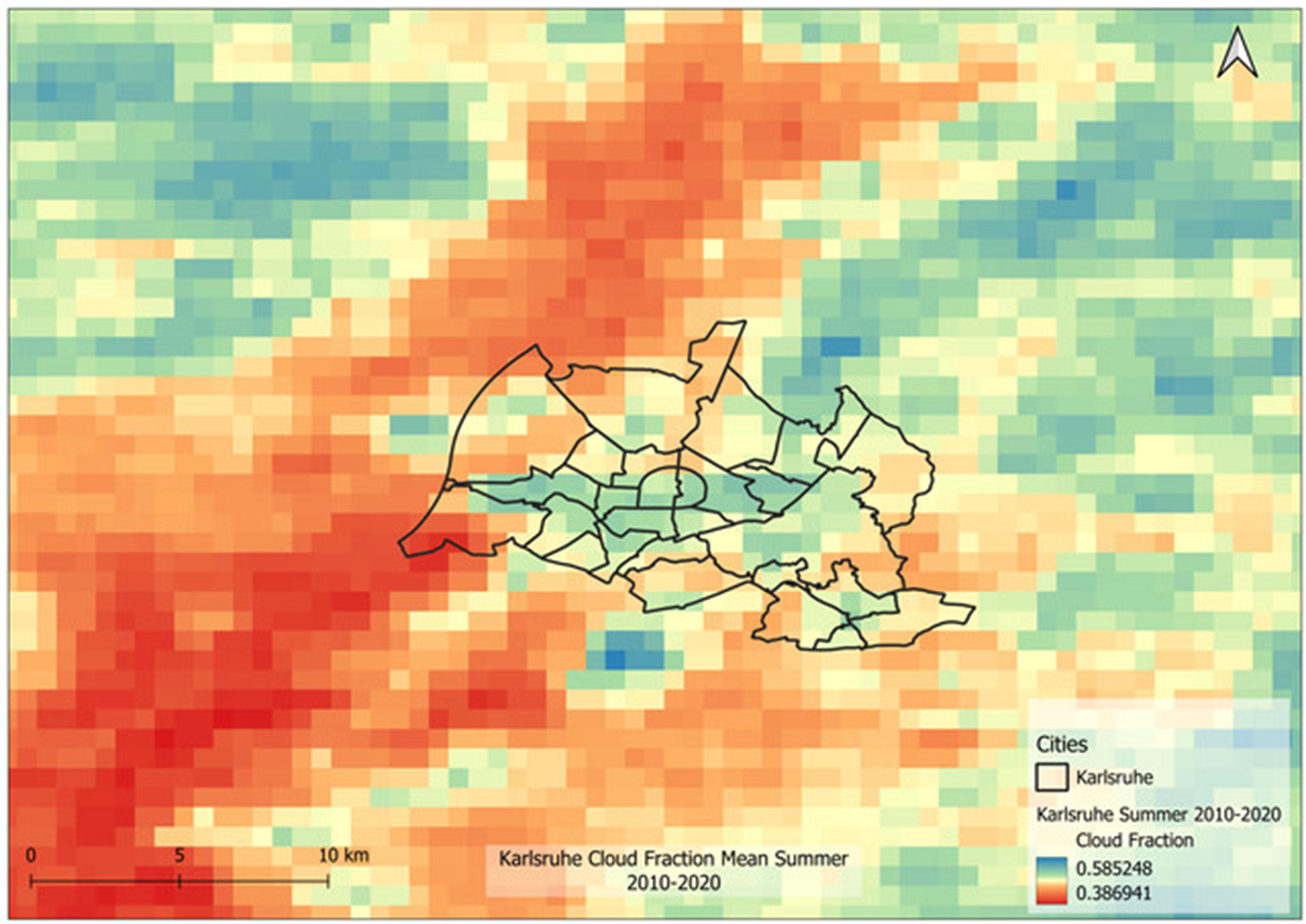
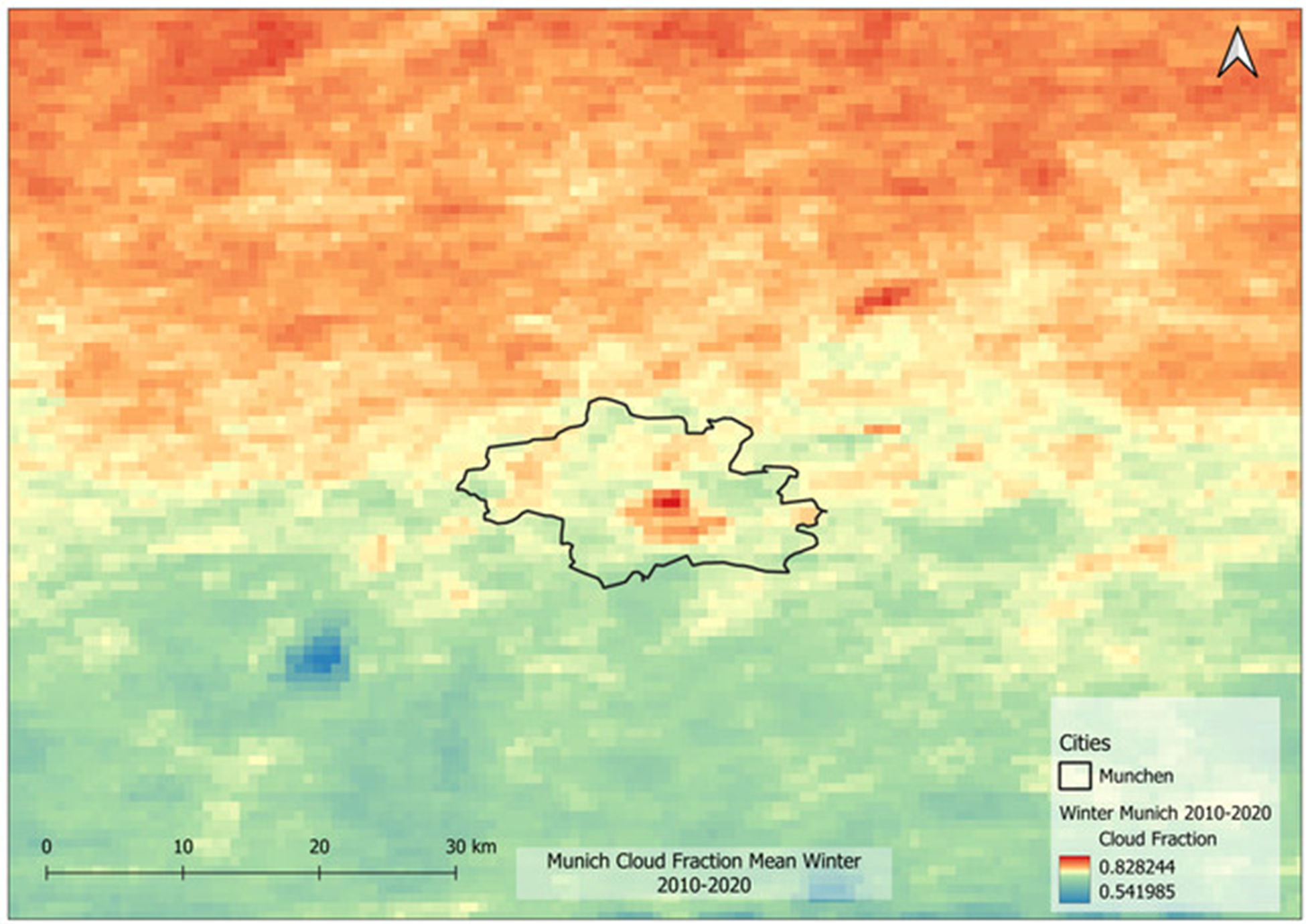
The cloud mask was decoded from the state_1km QA bits of MODIS. Images were filtered by season and averaged over the 10-year period to produce cloud frequency maps. A combined Terra + Aqua dataset increased the frequency of observations.
Results
The resulting maps and animations clearly show differences in cloud presence between seasons and cities. Paris and Munich showed consistently high winter cloud coverage, while Milan had lower cloud fractions in summer. The method provided clear, interpretable outputs useful for further urban or climate-related studies.
Code Access
You can view the Earth Engine script used in this analysis here: