What Was Done?
Geological, geomorphological, and superficial geological formation mapping was carried out at a 1:2000 scale along 32 km of road connecting Ubalá to Gachetá in Cundinamarca. The study addressed rock falls, pavement damage due to subgrade conditions, among other issues.
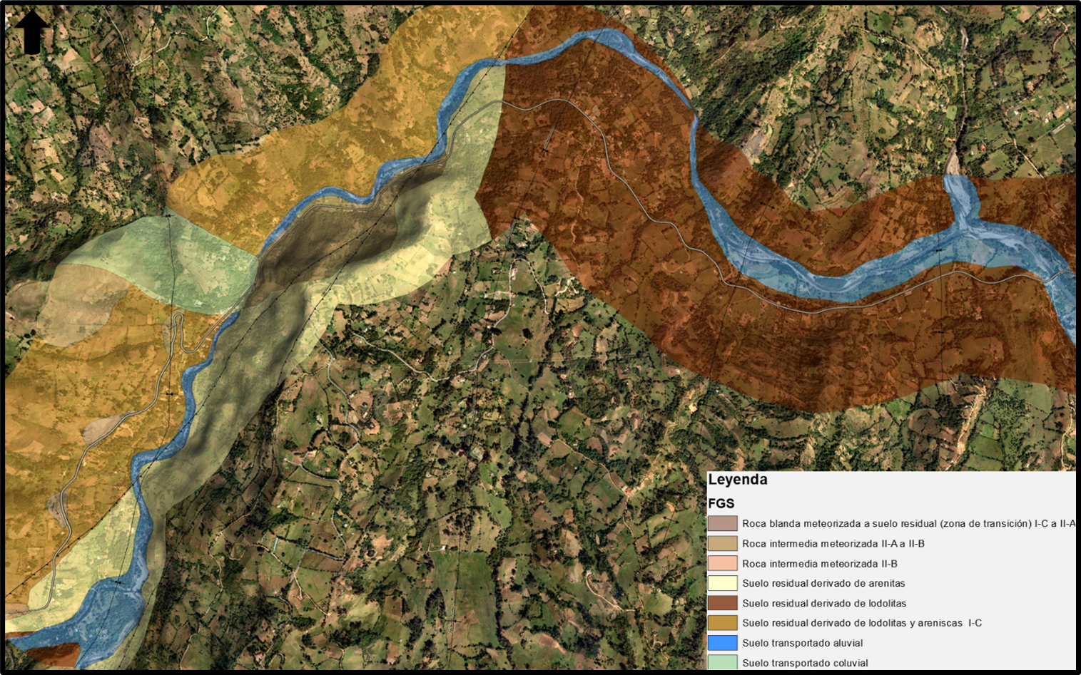
Secondary data was compiled to obtain the regional geological context, including disaster inventories, geospatial data, aerial photo interpretation, and other relevant information. In field visits, this pre-analyzed information was contrasted and refined, resulting in a detailed geological mapping of the outcropping materials along the road.
Potential geological and hydrometeorological risk factors—such as active denudation processes and geological faults—with direct or indirect impact on the project were identified.
Methodology
Project ICCU-CM-049-2019: “Studies and Road Designs to Improve the Competitiveness of the Department of Cundinamarca”
Based on the identified risk factors, critical points were defined with descriptions and general recommendations. These points were prioritized by severity to determine where more detailed studies were necessary. The recommendations ranged from percussion and rotation drilling and additional multidisciplinary visits to drone flights for extensive denudation areas and detailed rock slope studies.
Deliverables
- Geological volume for engineering purposes
- Geology, geomorphology, and superficial geological formation maps
- Critical point reports
- Mapping of the FGS for one of the road sections
- Critical point sheet
Rock Slope Annex
The aim was to provide technical guidelines based on geological and geotechnical knowledge for implementing engineering solutions on rock slopes that could affect the project directly or indirectly.
What Was Done?
Methodology: The following studies served as a guide:
- "Rockfall on Slopes; A Guide for Risk Assessment on Roads" (Arango, 2014)
- "The modified 'Rockfall Hazard Rating System': A New Tool for Road Risk Assessment" (Budetta, 2003)
.png)
Tools were used to optimize the capture and processing of structural data compared to the traditional compass method, and to set up geomechanical stations along the slopes. Stations were established in sections to record parameters such as slope height, road width, collecting ditch width, and rock fall sample sizes.
For RMR classification—due to the lack of commercial software—a custom template was programmed in Visual Basic for Excel to automate the process. Later on, I adapted the same idea into a Python script. For SMR classification, a free program developed by the University of Alicante was used.
.png)
A statistical treatment of the captured data was conducted and represented in stereograms to visualize types of slope failure. A hazard score was assigned to road sections for rock falls by considering additional factors such as vehicular traffic, visibility, and braking distance.
.png)
.png)
Finally, rock block trajectories were modeled and drone flights were performed in some cases. This process allowed for the prioritization of slopes that required intervention.
.png)
.png)
.png)
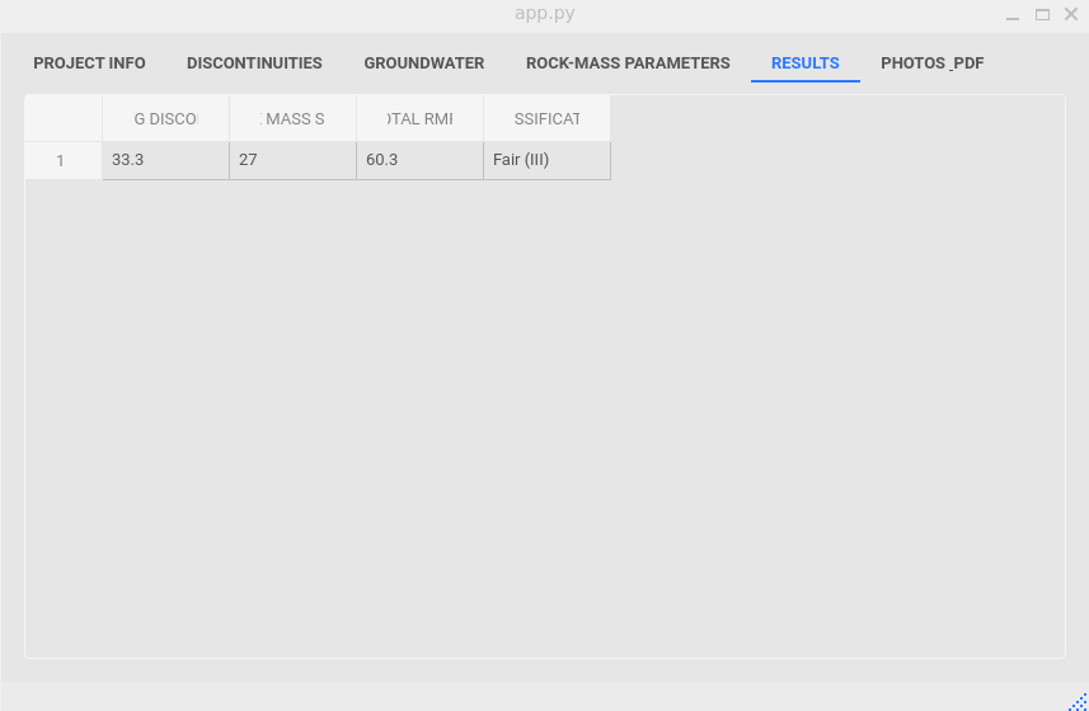
Outcome: Eight slopes were proposed to be mitigated with simple and cortical reinforcement meshes. (RMR format – self-developed; SMR based on Riquelme, A. & Tomás, R. & Abellán A, 2014; rock fall modeling; stereogram fracture analysis; RHRS classification.)
Visit the repository of the Rock Mass Rating classification software here:
Rockmassclassification repository